Data services setup
WebDAV data folder
A WebDAV folder is available to manage geospatial data used for mapping services:
Upload the data to GeoCat Live GEOSERVER_DATA_DIR/data/:
-
Resource Browser: Depending on your network connectivity your geospatial data may be managed using
Tools❯Resource Browser: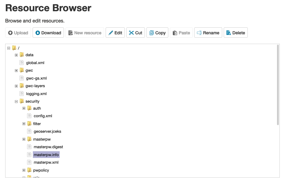 Resource browser
 -
WebDAV: For working with large raster files use WebDAV to access
GEOSERVER_DATA_DIR/data/folder.Restricted Files
Upload files to
datain Geoserver'sdatadirectory, these files are not available for downloads. The files can be used for layers in GeoServer.Server http://localhost:8080/data/mapUsername: geoserverPassword: Provided by email Public Files
Make files available in http://localhost:8080/mapping/www (directory
wwwin Geoserver's data directory) for downloadingServer http://localhost:8080/data/mapUsername: geoserverPassword: Provided by email In the browser window there is no file list, a link should be to a file directly. For example: http://localhost:8080/mapping/www/test.txt
WebDAV support is build directly into Windows and macOS and is widely supported by file transfer utilities:
Note
-
Map a network drive in Windows 10
Tip
When mapping a network drive choose a custom location and Internet or network address to provide the WebDAV folder location above.
-
PostGIS Database
A PostGIS Database is available to support GeoCat Live mapping services:
-
GeoServer requires one PostGIS (JNDI) Data Store for each workspace making use of PostGIS.
All data stores will be configured using the same connection pool using Java Naming and Directory Interface (JNDI) reference
java:comp/env/jdbc/postgis.Navigate to
Data❯Storespage, and click Add new Store. -
From the listing of
Vector Data Sourcesclick PostGIS (JND). -
Fill in basic store info:
Workspace (select your workspace here) Data Source Name PostGISDescription PostGIS Database for GeoCat Live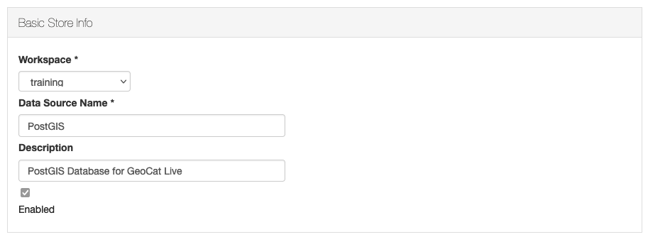 GeoCat Live PostGIS Database information
 -
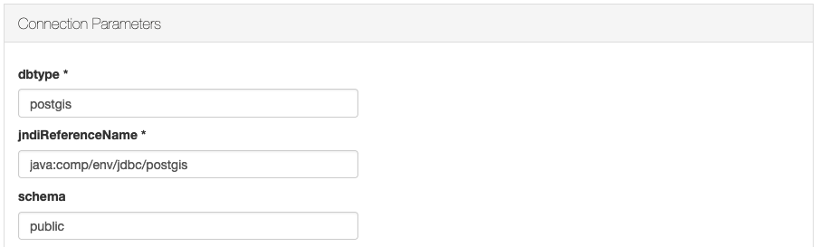
Fill in connection parameters required to access GeoCat Live services:
dbtype postgisjndiReferenceName java:comp/env/jdbc/postgisschema publicFor more information on connection parameters see PostGIS
 GeoCat Live PostGIS JNDI Connection parameters
 -
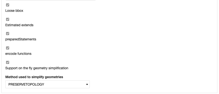
The following connection parameters are recommended:
Loose bbox checked Estimated extends checked preparedStatements checked encode functions checked Support on the fly geometry simplification checked Method used to simplify geometries PRESERVETOPOLOGYThese settings allow mapping services to simplify the geometry based on pixel size, and provide a binary transfer of data using TWKB format for increased performance.
For more performance tradeoffs see PostGIS performance considerations
 GeoCat Live PostGIS Performance recommendations
 -
With the database connection established you can:
- Publish any tables as GeoServer layers
- Create PostGIS Tables from a shapefile using importer
Note
Contact support if you wish to request direct access to this database, for use with a Desktop GIS application and GeoCat Bridge.
GeoCat Enterprise Basemap
GeoCat provides a basemap for use with catalogue services:
- Visit GeoNetwork Enterprise minimal view configuration instructions