Minimal view
At GeoCat we've developed this view as an alternative to the default GeoNetwork view. The view has a subset of functionality available, therefore it looks plain and clear.
Minimal is the default view in GeoNetwork Enterprise. Configure alternative views via Admin ❯ Settings in the field User interface configuration.
Note
Start typing interface in the filter settings
Configure the view
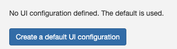
To configure the view, go to Admin ❯ Settings ❯ User Interface. Click the button Create a default UI configuration, to create
a default user interface configuration.
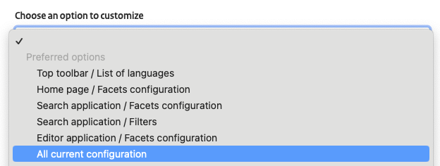
Once created select the option All current configuration to display all the user interface options:
In the following sections are described the options to configure use the Minimal view. Once the changes are applied, click the button Save settings.

Search results layout
The Minimal view uses customised templates for the search results.
To display the search results with the proper layout, in the Search application section and configure:
-
List of templates for search results:../../catalog/views/minimal/templates/list.htmlwith iconfa-barsand tooltipList.../../catalog/views/minimal/templates/grid.htmlwith iconfa-thand tooltipGrid.
-
Default template used for search resultswith the value../../catalog/views/minimal/templates/list.html.
Map configuration
To use a GeoNetwork Enterprise maps, go to Admin ❯ Settings ❯ User interface configuration and follow these steps:
-
In
Viewer Map ConfigurationsetPath to the context file (XML)to../../catalog/views/minimal/config-viewer-gne-map.xmland set the coordinates to:- MinX:
-8604130.477526832 - MinY:
-320097.07393612247 - MaxX:
8948257.201654762 - MaxY:
8720263.135408245

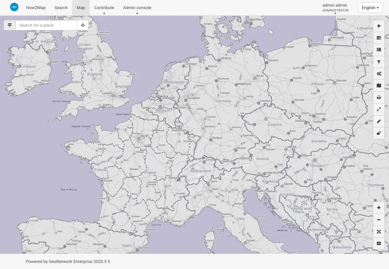
The map viewer with the custom GeoNetwork Enterprise map:
- MinX:
-
In
Search Map ConfigurationsetPath to the context file (XML)to../../catalog/views/minimal/config-viewer-gne-search.xmland set the coordinates to:- MinX:
-180 - MinY:
-90 - MaxX:
180 - MaxY:
90
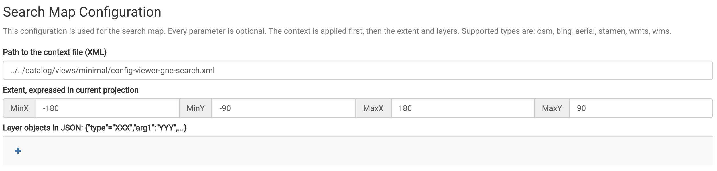
You can also use the settings for the
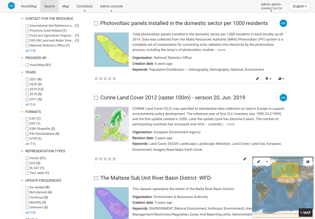
Viewer Mapif you want to change maps.The custom GeoNetwork Enterprise map on the Search page:
- MinX:
-
In
Editor Map ConfigurationsetPath to the context file (XML)to../../catalog/views/minimal/config-viewer-gne-editor.xmland set the coordinates to:- MinX:
-180 - MinY:
-90 - MaxX:
180 - MaxY:
90
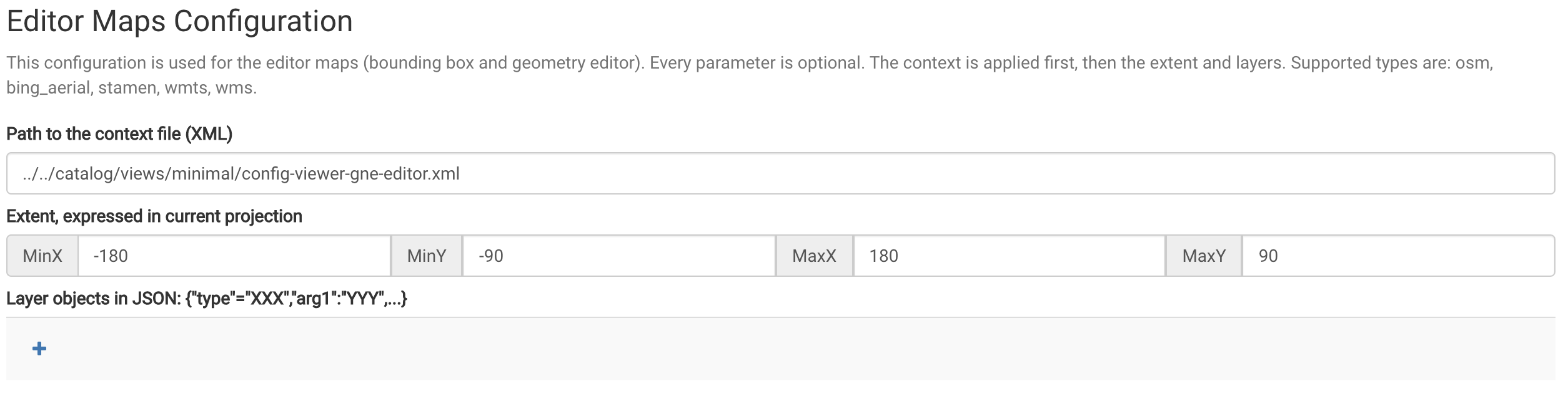
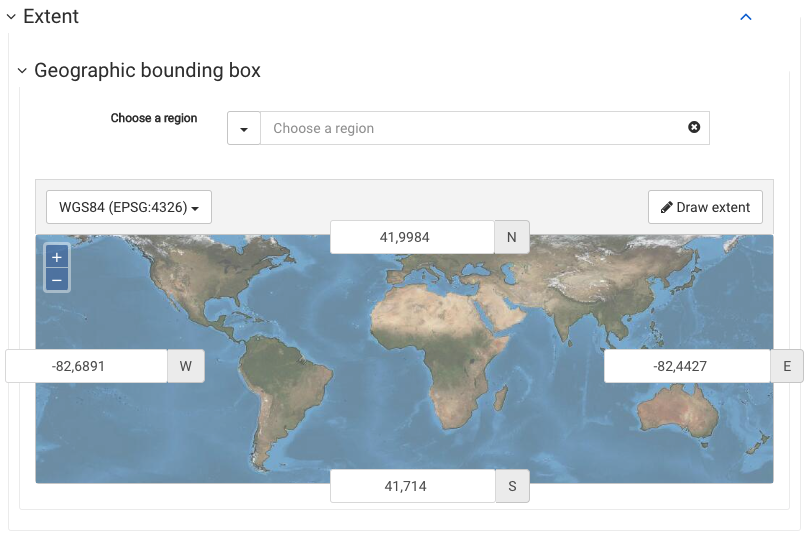
The editor with the custom GeoNetwork Enterprise map:
- MinX:
-
Remove any eventually existing settings for
Layer objects in JSON -
The
Viewer MapusesEPSG:3857and the others useEPSG:4326.