
Established in the Netherlands in 2007, GeoCat offers cutting-edge customized software and services that make publishing geospatial data on the Internet easier and more efficient. Operating in the fast growing market of Spatial Data Infrastructures (SDI) and geospatial-enabled technologies. GeoCat builds sustainable applications following the Free and Open Source Software (FOSS) philosophy and open standards.
Therefore, GeoCat has provided successful consulting services and products that contributed to the development of National Spatial Data Infrastructures for The Netherlands, Switzerland, Norway, Sweden, Finland, Denmark, Scotland, The European Space Agency and many others.
Our Team

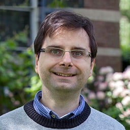
Jeroen Ticheler
CEO/Owner – Chair and founder of the GeoNetwork opensource
GeoCat was founded by Jeroen Ticheler in 2007. Ticheler studied Tropical Forestry at Wageningen University specialising in GIS and Remote Sensing. Following graduation in 1997, he worked for the UN Food and Agricultural Organization (FAO) in Rome for nine years. Ticheler held various positions for the FAO in GIS/remote sensing and established the GeoNetwork opensource project. The FAO GeoNetwork is the first implementation based on this software, releasing a large quantity of geospatial data to the public. Today GeoNetwork opensource is accepted as the definitive open source geospatial catalogue application with implementations from smaller projects to national and international level catalogs.
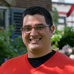
José García Segura
Software Analyst
Jose is a software engineer who has worked mostly in geospatial software development, both with proprietary and open source software solutions. He started working at GeoCat in 2009, where he is involved in software development for several projects using GeoNetwork opensource and GeoCat Bridge. He is a core committer on GeoNetwork opensource. In his spare time he likes watching movies while enjoying a nice Belgium beer.

Jody Garnett
Senior Developer
A grounded technologist, Jody loves the impact geospatial solutions can have for our customers and the world. Joining our team from Canada, Jody applies his enthusiasm and customer focus to GeoCat Live and GeoServer Enterprise offerings.
Jody graduated from Simon Fraser University in 1997 kick starting a professional career first in Business Intelligence and then GIS Systems. Jody is pleased to have helped organizations worldwide succeed with OGC Standards and open source technology.
Jody has deep roots as an open source community builder and advocate. He serves on the steering committee of the GeoServer, GeoTools and ImageN projects, and as a committer with JTS, GeoGig, uDig and more. Jody contributes to OSGeo and LocationTech foundations helping teams succeed through an open approach to software development.
When not working Jody can be found enjoying the Vancouver Island lifestyle and its many outdoor activities.

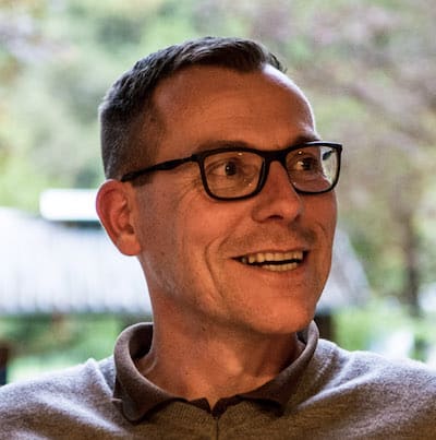
David Blasby
Software Developer
With over 20 year history in open source GIS, David knew many of GeoCat’s core technologies upon his arrival.
He is the original developer of PostGIS, and has been the engineering lead for GeoServer and GeoGIG. He has wide experience in many development technologies – Java, C#, Python, and Javascript. What drives him is providing products that people love to use and making them “Blastastic” (a cross between “Blasby” and “fan-tastic”).
David loves challenges – even in his free time. He has experience in rock and tree climbing as well as cave diving, and now considering climbing waterfalls. You can’t escape his contagious laughter. When David modestly says something is cool, it’s definitely supercool!
Juan Luís Rodríguez Ponce
Software Engineer
Juan Luis is an Open Source enthusiast. He really believes that sharing our knowledge makes the world move forward.
He has been working with open source technologies since he started studying at the university. In the meantime, he has been developing GIS related projects since about 2006 at work. MapServer, GeoServer, routing engines, PostGIS, …
Juan Luis also contributes to OpenStreetMap, a free worldwide map everybody can edit and improve, contributing to Open Knowledge development.
Michel Gabriël
Front End Developer
Michel is a software engineer since 1997. He graduated in Tropical Land and Water Management at Wageningen University and soon specialized in GIS and started programming and building in ArcView Avenue.
He quickly switched from desktop to online geospatial applications, having worked with Mapserver, GeoServer and OpenLayers. Being someone with a keen eye for graphics and layout he moved gradually to front end development. Michel always wants to make complex (geospatial) applications look simple.
When he is not working he is either traveling, hiking or reading a lot of comic books.

Sander Schaminee
Software Developer

Rosa Briones
Test Engineer
Latest Blog Posts

GeoCat commits as Diamond Sponsor to OSGeo
Longtime leader in Free and Open Source Geospatial software and services demonstrates commitment to OSGeo with the highest level of sponsorship.
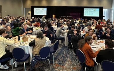
FOSS4G NA 2023
I had the great privilege to attend FOSS4G NA 2023 in Baltimore last month and catch up with the North American geospatial community. This was the first large regional event since Covid and it has been a long time since the last FOSS4G 2019 event in San Diego!...
Cyber Resilience Act
As a small and medium business operating in Europe GeoCat BV is clearly affected by the forthcoming European Cyber Resilience Act (CRA). We are a proud open source company and are concerned about our friends and partners caught up in the uncertainty around this...


