Dutch view
Dutch view is a view plugin for GeoNetwork Enterprise. A view generally consists of a number of overrides for templates (html), styles (less) and scripts (js).
Features:
- Design slightly follows dutch rijkshuisstijl
- Introduces PDOK background layers as map backgrounds
- Introduces PDOK locationserver as gazetteer
To install the plugin, follow the generic installation instructions for view plugins.
Select the view
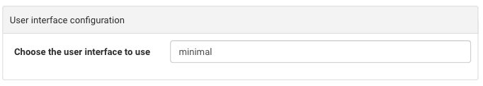
In order to use the Dutch view you first have to go to Admin ❯ Settings ❯ User interface configuration.
Note
Start typing interface in the filter settings
Change the view to dutch (lowercase).
Configure the view
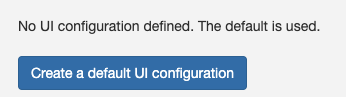
To configure the view, go to Admin ❯ Settings ❯ User Interface. Click the button Create a default UI configuration, to create
a default user interface configuration.
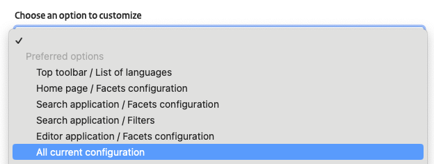
Once created select the option All current configuration to display all the user interface options:
In the following sections are described the options to configure use the Dutch view. Once the changes are applied, click the button Save settings.

Application layout
To use a fixed width layout for the application:
- In the
Top toolbarsection, disable the option Fluid container for Header and Top menu. - In the
Home pagesection, disable the option Fluid container for Home and Search
Search results layout
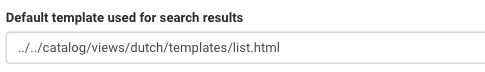
To display the search results with the proper layout, in the Search application section find the option Default template used for search results and set the value to ../../catalog/views/dutch/templates/list.html.
Adding facets on top of the search results
To add facets-display, navigate to Admin ❯ Settings ❯ User Interface ❯ Display filter tags in the search results and select the corresponding option.
Map configuration
To use a Dutch map and Dutch coordinates, in the section Map application follow these steps:
-
In
Viewer Map Configuration,Search Map ConfigurationandEditor Maps ConfigurationsetPath to the context file (XML)to../../catalog/views/dutch/config-nl-viewer.xml.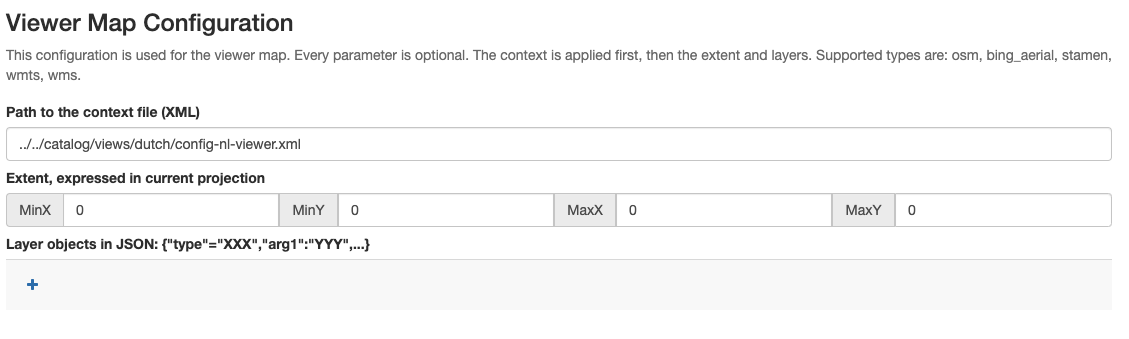
-
In
Map projectionandList of map projections to display bounding box coordinates inaddEPSG:28992: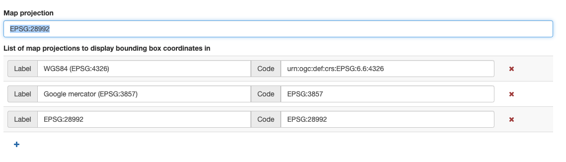
-
In
Projections to display maps intoadd theEPSG:28992configuration:Definition:
+proj=sterea +lat_0=52.15616055555555 +lon_0=5.38763888888889 +k=0.9999079 +x_0=155000 +y_0=463000 +ellps=bessel +towgs84=565.417,50.3319,465.552,-0.398957,0.343988,-1.8774,4.0725 +units=m +no_defs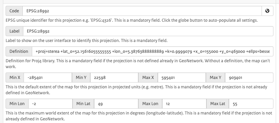
Dutch search terms
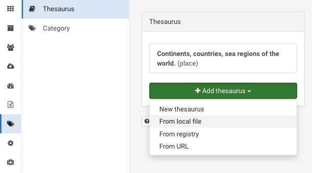
To search using a Dutch gazetteer, set the thesaurus used by the location-search (homepage), download file from Nationaal Georegister and upload it in Admin ❯ Classification ❯ From local file. It replaces the default regions thesaurus.
Add Dump Fields
Dutch schema's use a number of extra lucene fields, which need to be configured to be included as part of a search result. Open /web-inf/config-lucene.xml and add within the
<!-- extra dump fields for dutch view -->
<field name="license" tagName="license"/>
<field name="licenseLink" tagName="licenseLink"/>
<field name="payment" tagName="payment"/>
<field name="protocol" tagName="protocol"/>
<field name="specificationTitle" tagName="specificationTitle"/>
<field name="specificationDate" tagName="specificationDate"/>
<field name="specificationExplanation" tagName="specificationExplanation"/>
<field name="degree" tagName="degree"/>
<field name="conditionApplyingToAccessAndUse" tagName="conditionApplyingToAccessAndUse"/>
<field name="useLimitation" tagName="useLimitation"/>
<field name="standardVersion" tagName="standardVersion"/>
<field name="_national" tagName="national"/>
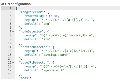
Export/Import settings
If you want to export your current settings locally (for archiving or port to another instance), go to the end of the page JSON Configuration, copy the JSON and paste it in a text editor and save the file.